


Regional information - The Event location
The operating area of the Upper Sand Ridge Rural Development Association is located 40 km from Budapest, between the Danube and the Tisza River, in the geographical center of Hungary.
The operating area is identical with 24 government areas, which has a total population of 88 thousand people and an area of 1 100 km2.
Our settlements belong to region of Central Hungary, located in the southern part of Pest County, in the southern boundary of the agglomeration around Budapest.
Dabas is the largest city, the center of this region and the venue for the opening event as well. Its historic buildings were built at the beginning of the 18th century, on the lands of noble families farming here. It still defines the image of the town. People who live here are highly attached to the rural way of life. The image of the town-except the main square- reflects the rich architectural traditions of Hungarian lowland villages.
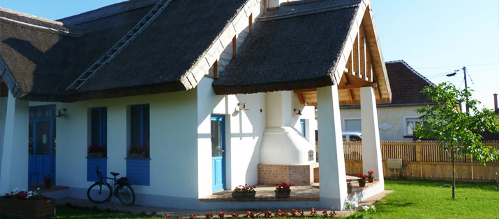
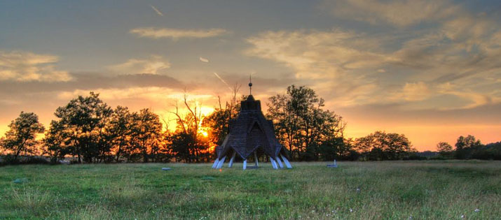
The base of LINC Event 2016 is Club Hotel Sarlóspuszta that belongs to Tatárszentgyörgy village, which is the southern settlement of Pest County. The oldest archaeological findings have remained from the Bronze Age. According to the sources, the name of the village as it is known was first mentioned in 1507.
The village and the whole region were depopulated during the 15-year war between Habsburg Empire and the Ottoman Empire. The repopulation gradually followed over the end of 18th century.
During the event, several settlements will be visited. Among them will be Ráckeve, which is the biggest town of Csepel island with a population of nearly 10 000.
Újhartyán, a place very near to the highway, will be the venue for the opening and closing dinner, but during the project visits, participants can also familiarize themselves with other places of our operating area.
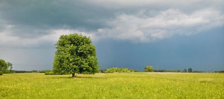
The region covers a variety of habitats with a large number of significant, rare/protected species. Grasslands and wetlands, forests, tablelands, fields and utilized agricultural lands come one after the other. The dunes are of outstanding importance. The varied terrains and soil types, and their combinations make the landscape unique. Among the dunes, saline lakes were formed along the channels. Today, only a few of them are filled with water, most of them dried out and turf has replaced it. Unfortunately, the drying process made some negative changes in wildlife, impoverishment appeared in some areas.
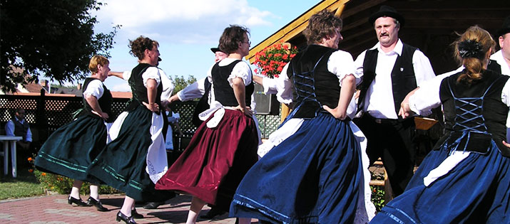
Cultural values of the region are unique. Traditional farming and the typical farm life played an important role in the image shaping of Kiskunság landscape. Their maintenance is essential to conserve natural values. We must emphasize the preservation of genetic heritage, the extensive conditions of original prairie environment of the ancient Hungarian domestic animals and the support of Kiskunság pastoral lifestyle memories. The natural and ethnographic treasures are jointly linked to the culture of lowland farming
About the nature - About the "Puszta":
The venue of the event is Club Hotel Sarlóspuszta that is in the neighborhood of Kiskunság National Park and has the largest reception capacity in the surrounding area.
This tourism area, which has been a traditional farmland formerly, welcomes its visitors with the view of „Puszta”. The property is located 8 km from the center of Tatárszentgyörgy, 16 km from the town of Dabas.
With its colorful world of horse-breeding farms, village tourism, spas, wines, food specialities and various cultural and ethnographical values, the Danube-Tisza Interfluve region provides great opportunities for tourism. Yet, it is the wonderful landscape that frames all the attractions. The true aspect of the landscape and the untouched beauties of nature are to be traced in nature conservation areas.
The Danube-Tisza Interfluve has been formed by alluvial deposits of the old Danube. The row of deposits has settled on the alluvium in the river from quick sand or loess blown by the wind. The watershed along the low backbone equals 7500 km2 Hátság divides the sandy area – both in a hydrological and biogeographical sense – into a narrow western and a wider, less steep slope. In the west the Hátság steeply inclines towards the Turjánvidék – rich in water – and the Őrjeg, whereas the eastern slope easily blends into the former flood area of the Tisza River.
The major part of the Homokhátság is made up of mound ridges standing out of their environment by 10-15 m. Its soil is quicksand, the majority of its surface has already been bound by vegetation. The Hátság is poor in surface waters as the precipitation quickly seeps into the ground or seeps down towards the river valleys. In the flats among the mounds shallow sodic lakes have formed. Most of the them have dried out by now as a result of changes in the weather and of human activities, they are covered by water only in the rare rainy years.
More info here: http://knp.nemzetipark.gov.hu/the-protected-areas-of-the-homokhatsag
Map with place names